
Start a Missouri City Street Search
Use the exact address as the first anchor. In Missouri City, an address can point to a city map result, a county locator point, an appraisal situs, and a USPS delivery label that do not say precisely the same thing. Begin with the city address viewer to test municipal jurisdiction. Next, use Fort Bend Central Appraisal District, or FBCAD, to locate the parcel card and preserve the situs address, legal description, owner name, tax year, and geographic or quick-reference identifier shown there. Those identifiers make later record checks less dependent on a street-name match.
The address workflow then moves from land to documents and only then to dated household evidence. The County Clerk's official-public-records index is not an address search. Its key fields are parties, dates, instrument number, and document type. Resolve the FBCAD owner or legal description first, search the party or instrument in the index, and compare the legal description in the instrument with the parcel card. Fort Bend voter information and historical directories can be useful leads, but neither a voter entry nor a directory line alone proves current occupancy.
- Enter the complete address in Missouri City MyCity GIS and note whether it resolves inside city jurisdiction.
- Search FBCAD by street number and street name, then record the tax year, parcel identifiers, situs, mailing address, and legal description.
- Check the city street segment and Fort Bend address-point layer for range, side, ZIP, postal-city, and alias or history fields.
- Use the FBCAD owner or the instrument number in the County Clerk OPR index, then compare parties and legal description before treating records as related.
- For an older address question, use regional telephone directories, newspapers, or library collections as date-stamped context rather than a current-household list.
Note: Preserve the spelling, unit, street type, retrieval date, and source update date for each Missouri City result because changes in street, postal, and appraisal data are not synchronized.
Missouri City GIS Address Resolution
The Missouri City MyCity GIS address viewer is the right first check for city jurisdiction. Its address lookup is limited to Missouri City jurisdiction, so a miss is not proof that an address is invalid or that a person is absent. It may instead be outside the incorporated area, use a different spelling, fall under a postal-city label, or require a county source. Record the selected address output as a municipal map result, not as a property-line certification.
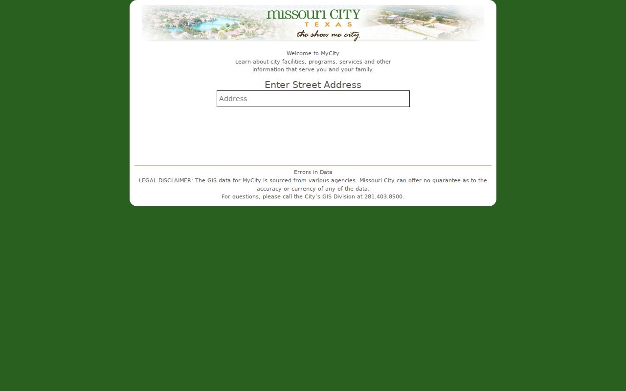
The viewer is a useful start because it distinguishes a city-jurisdiction lookup from a postal or appraisal record. Follow it with the county and appraisal layers when a Missouri City address needs a broader records crosswalk.
Missouri City GIS also provides interactive and static layers for city limits, council districts, MUDs, police beats, floodplain, zoning, and parks. Those layers describe governmental or planning context. They do not make a map an ownership record, and they do not turn an address point into evidence that a named person currently lives there.
FBCAD Fields for Missouri City Streets
The FBCAD property search offers Search, ARB Search, and Advanced Search. For a Missouri City street-address task, the published controls support simple address and ownership research before a deed search begins. The appraisal district says a result card can show the owner name, owner mailing address, market or value information, situs address, legal description, taxing-unit codes, and a link to more public account information. Carry the tax year with each field because a roll is a year-specific record.
| FBCAD control | How it is used | Street-research value |
|---|---|---|
| Street Number and Street Name | Address text | Locates a situs candidate without assuming an occupant. |
| Owner Name or Owner ID | Name or identifier | Supplies a party lead for the OPR index and helps separate similar parcels. |
| Quick Ref ID, Geographic ID, or account | Parcel identifier | Creates a stable cross-reference for the parcel card and map. |
| Subdivision, Abstract, Condo, or Neighborhood | Lookup or dropdown | Connects a street address to development geography and a possible recorded plat. |
| Property Type and Tax Year | Filter | Keeps the research tied to the relevant record series and year. |
| Map result | Result card | Shows the published owner, mailing, situs, legal-description, value, and taxing-unit fields. |
FBCAD is the appraisal custodian, not a deed substitute. Its mapping information is a secondary representation based on deeds, plats, and other sources, and the county GIS gives a similar warning. A parcel card can identify an owner of record for a tax year, but it cannot establish that the owner lives at the situs, that a mailing address is the situs, or that every past owner appears on the current card.
Missouri City Street Records to OPR
Once a Missouri City parcel has a legal description or owner name, use the Fort Bend County Clerk Online Record Search for the recorded-document trail. The official-public-records, or OPR, system covers deeds, mortgages, liens, easements, plats, powers of attorney, bills of sale, assumed names, and other instruments. County pages describe historical online-library coverage differently, beginning in either 1821 or 1838 depending on the record-series page. Name the series and preserve the source wording instead of claiming one universal start date.
The County Clerk FAQ expressly says its public search does not search directly by street address or legal description. That is why the street directory sequence matters: FBCAD or GIS resolves the parcel, then the researcher uses party name, date range, document type, or instrument number. Inspect the recorded legal-description text and the parties against the parcel card. A similar surname or a shared street is not enough to join two records. Sealed, restricted, and redacted material should remain unavailable rather than be reconstructed from another source.
County Clerk locations include the Missouri City Annex at 5855 Sienna Springs Way, Missouri City, TX 77459, as well as Richmond and Sugar Land locations. Services vary by location. The research records a records email, telephone, and fax route, while the Clerk's fee page supplies the current copy and certification schedule. Use the official contact and fee pages before ordering because fees and temporary service notices can change.
Missouri City Street-Keyed Records
No single Missouri City address-record set names every household. The useful public sources are keyed to different things: jurisdiction, address geometry, parcel, recorded transaction, or dated directory entry. Reading them together makes the limits visible as well as the links. The table separates what each source can support from what it cannot safely prove.
| Address-keyed source | Custodian | What it can show | Access route |
|---|---|---|---|
| MyCity GIS | Missouri City GIS | Whether a selected address resolves in city jurisdiction | Public interactive map |
| Street-name layer | Missouri City GIS | Ranges, street sides, ZIP/city/county fields, subdivision, and road metadata | Public ArcGIS REST query |
| County address points | Fort Bend GIS | Address components, unit, alias/history, postal and city fields, source dates | Public ArcGIS REST query |
| FBCAD parcel card | Fort Bend Central Appraisal District | Owner, situs and mailing address, legal description, value, taxing units, tax year | Public property search |
| Recorded plat or deed | Fort Bend County Clerk | Lot, block, legal description, parties, instrument number, and filing date | OPR index, image, or copy route |
| Permit or code file | Missouri City departments | Public address, case, or permit details if released | Portal discovery or a narrow TPIA request |
| Voter data | Fort Bend Elections or Texas SOS | Legally public registration fields subject to protection rules | Individual inquiry or SOS request route |
| Directory or newspaper | Library, UT, or TSLAC | Dated name, address, phone, or local context | Digital catalog or in-house material |
For a record not available online, send a focused written request to the custodian that maintains it. Under the Texas Public Information Act, identify the record type, date range, street address, legal description, instrument or case number, and requested format. A city permit search did not yield a captured public result schema, so a portal miss should be treated as a research gap, not a statement that no permit or code record exists.
Missouri City Street-Side ZIP Fields
The Missouri City street-name layer is especially helpful where a street crosses a postal or municipal edge. Its published attributes include left and right ZIP, city, and county fields, plus left and right address ranges and an odd-even indicator. One side of a street can therefore carry a different postal or jurisdictional value from the other. The address number and parity must be checked before assigning a ZIP or city label to a location.
The Fort Bend County address-points layer adds ADD_FULL, unit, alias or history, city, postal, county, ZIP, address class, source, and created or modified date fields. It is a locator and source layer, not proof of ownership or occupancy.
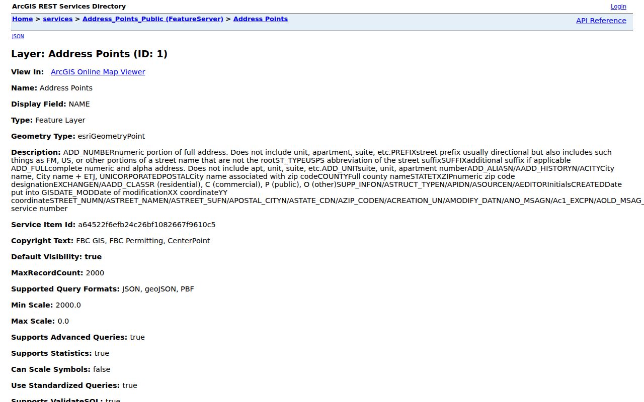
Use the county layer to preserve an address alias or postal field that may explain why a Missouri City address did not match the first city-map search. Compare the source and modified dates with the date of the deed or directory being studied.
Plats Shape Missouri City Street Names
A street name is not fixed forever. Missouri City says addresses within the city are assigned by CenterPoint Energy Mapping and Addressing; new street names come through subdivision plats and Planning and Zoning. Existing names may change by council initiative or a petition from 60% of property owners, and a private street can arise through a replat. The city does not maintain surveys or certify property lines. For a legal change, move from the street layer to a recorded plat or deed.
The Missouri City subdivision page identifies abbreviated, amending, conceptual, final, large-acreage, preliminary, and replat types. A plat can explain a lot or street relationship, while the County Clerk recording is the final recorded source. When a past address seems not to fit a current Missouri City street search result, keep the original form in the citation and compare prefix, suffix, street type, subdivision, section, legal description, and any address-point history.
This is also a practical boundary check. Missouri City city limits, the city's 3.5-mile ETJ, a postal city, a subdivision, a MUD, a county precinct, and an appraisal situs are distinct labels. A record may accurately use one of them while a searcher expects another.
Missouri City Street Directory History
For an older household question, use a dated source rather than reading present-day parcel data backward. The University of Texas Briscoe Center's Southwest Houston Suburban Telephone Directory citation covers Missouri City with Stafford, Sugar Land, and Richmond for 1975, 1980, 1985, 1986, 1987, 1991, and 1992 through 2005. Its Greater Houston residence white-pages run has many years from 1956 through 2005. No dedicated Missouri City directory run was located in the reviewed official sources, so the regional coverage must be named honestly.
The Briscoe directory search supplies location, directory type, year-from, year-to, and Browse controls. A scanned entry may contain a name, address, telephone, spouse or household notation, occupation, or ownership notation if printed. Record the title, publisher, edition date, page, and abbreviation key. A directory entry is a date-stamped lead, not continuous proof that someone remained at the address between editions.
Fort Bend Libraries adds newspapers, vertical files, microforms, obituary material, and census indexes at George Memorial Library. The regional directory collections are covered in more depth on the Missouri City city directories page, while this address research uses them only to test an address on a particular date.
Map Context for Missouri City Streets
Historical maps can place a street, lot, rail line, water feature, or building footprint in time, but they do not identify a current household. Fort Bend Libraries offers Texas Digital Sanborn Maps with in-library access for the broader 1867 to 1970 collection. The official research did not locate a standalone Missouri City Sanborn edition. That gap matters, because a map title or a nearby town should not be relabeled as a Missouri City sheet.
A documented local alternative is the 1956 Stafford-Missouri City map at TSLAC, published by the Texas Fire Insurance Department. It shows plat streets and roads, railroads, water lines, fire hydrants, and water systems. Pair its actual title, date, and sheet details with a recorded plat, OPR instrument, directory, or newspaper before attaching it to an address history. A road, subdivision name, or postal route can otherwise look like a modern street match when it is not.
Note: A historical map supplies built-environment context, so save the map date and archive identifier before comparing it with later Missouri City street, parcel, or directory data.
Missouri City Street Records Alert
The Fort Bend County Property Fraud Alert offers a free notification for a subscriber's name, business, or trust when a matching OPR filing is recorded. It can help someone watch for a new recorded filing connected to a name. It does not recover all earlier filings, validate title, identify every person connected with a parcel, or replace an instrument search and review of the recorded image.
The alert is a monitoring tool, not a street directory or title opinion. Pair any notice with the instrument number, filing date, document type, and legal description from the County Clerk record before drawing a property-history conclusion.
County Clerk staff state that the alert service does not perform research or provide legal advice or forms. If a payment letter or record offer appears suspicious, compare it with the official County Clerk URL and contact channel before paying or sharing details.
Street Directory Limits in Missouri City
Address research has firm boundaries. FBCAD's owner and mailing fields are appraisal information, not a roster of everyone who lives at a situs. A city or county map is secondary geography, not a certified survey or proof of a property line. The County Clerk's deeds document recorded interests and transactions, not household membership. A voter name, where lawfully available, is also subject to protected-address rules and should never be converted into a block-by-block personal profile.
- Parcel
- A defined tract or account used in the appraisal and mapping systems. It may have an identifier, but it is not itself proof of current residency.
- Situs address
- The property location shown on an appraisal record. It can differ from the owner mailing address and should be paired with the listed tax year.
- Plat
- A recorded map that can show lots, blocks, streets, easements, or a replat relationship. The recorded source is the legal trail to check.
- Criss-cross directory
- A reverse, address-oriented directory format used to locate a dated listing by address. Regional coverage may be scattered rather than annual.
Texas protects categories such as Social Security numbers, driver-license or DPS identifiers, protected voter addresses, sealed court material, and other restricted fields. When two records share a street or a name, require at least two independent matching elements, such as full name and legal description, instrument number and date, or a directly linked official identifier. A shared address by itself is not a reliable identity match.